| |
동해를 옛적부터 "한국해"로 표기한 서구 고지도 사례 |
| |
| ....................................................... Eintrag: 10.02.2012 |
|
| |
동해를 "일본해"라고 표기하지 않고 "한국해"(Meer von Corea, Mer de Corée, Sea of Korea)로 표기한 고지도가 인터넷에서 검색되어서 올린다.
1747년 Bowen 세계지도, 아시아
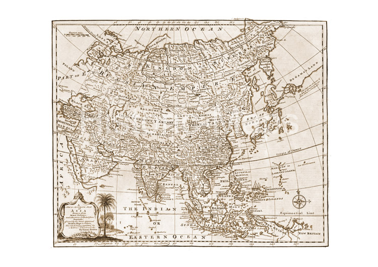
출처: Complete system of geography.
Being a descript-xion of all the countries, islands, cities, chief towns,
harbours, lakes, and rivers, mountains, mines, &c. of the known
world. London 1947 (http://www.historic-maps.de/rahmen.htm?http://www.historic-maps.de/karten-atlanten/weltatlanten/bowen-1747/galerie/pages/Asien-Asia%201747.htm)
"일본제국"이란 지도에 동해를 "일본해"와 "한국해"로 병기 표기하고 있다. (Empire du Japon".
Kupferstichkarte mit altem Grenzkolorit n. R.de Vaugondy bzw. P.Santini,
1778, bei (G.) Remondini, Venedig (1784).
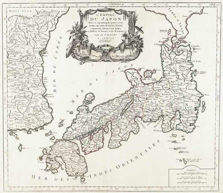
출처:http://www.kiefer.de/auktion_artikel_details.aspx?KatNr=6580
그리고 재독 독도 지킴이단이 원본으로 구입한 지도도 인터넷에 떠 있다.
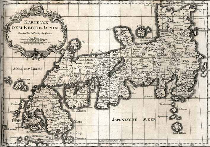
1763년 지도 동해를 "Meer von Corea"로 표기하고 있다 (원본 재독 독도지킴이 소장)
|
| |
  |
| |
|
|